



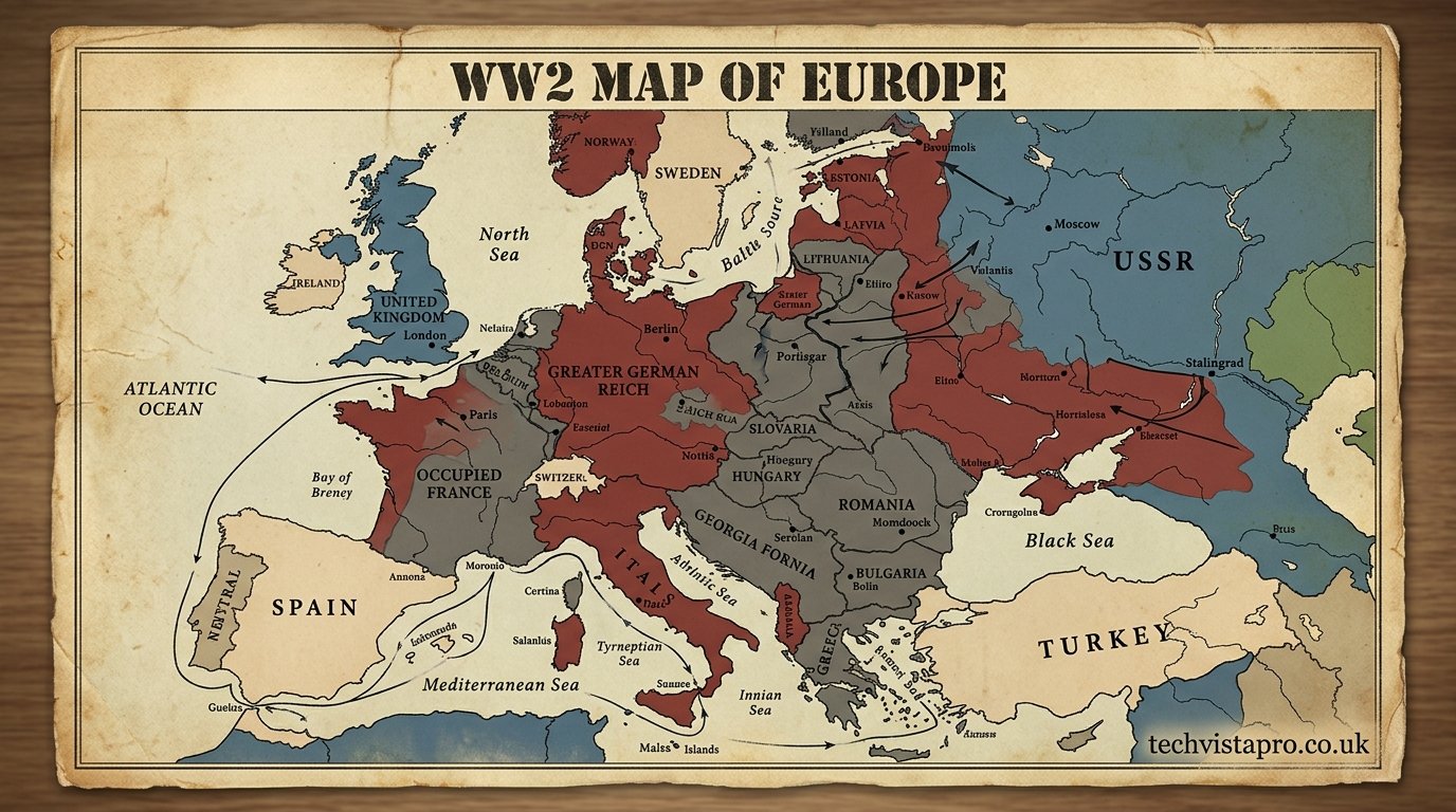
A WW2 map of Europe is one of the most powerful historical tools for understanding how the Second World War reshaped not only borders but also military strategy, political control, and human geography. Between 1939 and 1945, Europe transformed continuously as armies advanced and retreated, governments collapsed, and entire regions changed hands multiple times. These maps are more than static images; they are layered historical records that reveal how warfare unfolded across an entire continent.
Studying a World War 2 map of Europe allows historians and readers to follow the movement of frontlines, the expansion of occupied territories, and the eventual collapse of Axis control. Each stage of the war created a new version of Europe, making these maps essential for understanding how deeply the conflict reshaped global history.
The Fragile Political Map of Europe Before the War
Before 1939, the European map was already unstable due to political tension, economic pressure, and unresolved issues from the First World War. A pre-war WW2 map of Europe shows Germany rearming and expanding its influence after rejecting the Treaty of Versailles constraints. Austria had already been absorbed through Anschluss, and Czechoslovakia was dismantled through diplomatic pressure and territorial occupation.
At this stage, Europe appeared divided but not yet fully in conflict. Democracies such as France and the United Kingdom stood against rising authoritarian regimes, while the Soviet Union maintained its own strategic interests in Eastern Europe. The map of this period reflects a continent on the edge of collapse, where borders were still intact but increasingly fragile under political strain.
The 1939 Invasion of Poland and the First Major Map Shift
The invasion of Poland in September 1939 marks the first dramatic transformation on any WW2 map of Europe. Germany attacked from the west using Blitzkrieg tactics, while the Soviet Union entered from the east shortly afterward. This coordinated division resulted in the rapid disappearance of Poland as an independent state.
Maps from late 1939 show a clear partition of Polish territory, reflecting the secret agreements of the Molotov-Ribbentrop Pact. This moment is critical because it demonstrates how diplomacy and military force combined to redraw Europe almost overnight. The war had officially begun, and the map of Europe would never return to its pre-war structure.
The Fall of Western Europe and Rapid German Expansion
By 1940, the WW2 map of Europe changed dramatically as Germany launched rapid invasions across Western Europe. Denmark and Norway were occupied to secure naval routes and resource access, while Belgium, the Netherlands, and Luxembourg were overrun during the push toward France. These campaigns demonstrated the effectiveness of coordinated armored warfare and air superiority.
France’s collapse in June 1940 created one of the most significant map changes of the war. Northern France came under direct German occupation, while the Vichy regime controlled the southern region as a collaborationist government. At this stage, the map shows Axis dominance across much of continental Europe, with only the United Kingdom remaining as a major unoccupied Western power.
The Strategic Importance of the Eastern Front Map
The invasion of the Soviet Union in 1941 marked the beginning of the largest and most complex theater of war in Europe. A WW2 map of Europe during this phase shows a massive eastern front stretching thousands of kilometers. Germany advanced rapidly into Soviet territory, capturing regions in Ukraine, Belarus, and western Russia.
However, the Eastern Front was not static. By 1942 and 1943, Soviet resistance began to slow and then reverse German advances. Major battles such as Stalingrad and Kursk created visible turning points on the map, where German lines began to contract. This shifting frontline demonstrates how geography, logistics, and climate played crucial roles in determining the outcome of the war.
Occupied Europe and the Structure of Control Zones
One of the most complex aspects of a WW2 map of Europe is the system of occupation zones established by Nazi Germany. Occupied territories were not governed uniformly but instead divided into administrative regions designed for control, exploitation, and military efficiency. Poland was transformed into the General Government, while parts of Eastern Europe were organized into Reichskommissariats.
Western Europe also displayed varied levels of control. France was split between direct German occupation and the semi-independent Vichy regime, while countries such as Belgium and the Netherlands were fully occupied. In contrast, some nations operated under Axis influence without direct annexation, creating a layered political geography that is clearly visible on wartime maps.
The Allied Counteroffensive and Reversal of Axis Gains
From 1943 onward, the WW2 map of Europe began to shift in the opposite direction as Allied forces gained momentum. The invasion of Italy marked the collapse of Fascist control in Southern Europe and opened a new front against German forces. This campaign caused Italy to split between Allied-controlled southern regions and German-occupied northern areas.
By 1944, the Allied invasion of Normandy became a decisive turning point. The map shows a new Western Front emerging as Allied troops pushed eastward through France and Belgium. At the same time, Soviet forces advanced from the east, creating a two-front collapse of German defenses that rapidly reduced Axis-controlled territory.
The Final Collapse of Germany and the 1945 Map
By early 1945, the WW2 map of Europe shows Germany surrounded on multiple fronts. Allied forces advanced from the west while Soviet armies pushed through Eastern Europe into German territory. Cities such as Berlin became central battlegrounds, marking the final stage of the European war.
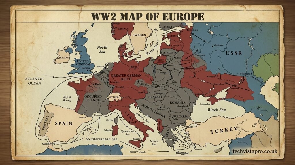
The surrender of Germany in May 1945 completely redrew the map once again. Territories previously controlled by the Third Reich were divided among Allied powers or returned to independent governments. This final map of 1945 reflects not only military defeat but also the beginning of a new political order in Europe.
Post-War Europe and the Redrawing of Borders
The end of World War II created one of the most significant border transformations in European history. A post-war WW2 map of Europe shows Germany divided into occupation zones controlled by Allied powers. This division later became the foundation for East and West Germany during the Cold War period.
Eastern Europe also experienced major territorial changes. Poland’s borders shifted westward, the Soviet Union expanded its influence across multiple states, and several Baltic regions were incorporated into Soviet territory. These changes permanently altered the political geography of Europe and shaped decades of Cold War tensions.
The Historical Importance of WW2 European Maps
WW2 maps of Europe are essential for understanding the complexity of modern military history. They illustrate how rapidly frontlines shifted and how entire countries could change control within days or weeks. These maps are widely used in historical research, education, and strategic studies because they provide a clear visual representation of the war’s progression.
Beyond military analysis, these maps also reveal the human consequences of the conflict. Each territorial change represents displacement, occupation, resistance, and survival. They help explain how millions of people were affected by shifting borders and how Europe’s modern political structure emerged from wartime destruction.
Conclusion: The Living History Within WW2 Maps of Europe
A WW2 map of Europe is not simply a geographical illustration but a detailed record of one of the most transformative periods in human history. From the invasion of Poland to the final collapse of Nazi Germany, each phase of the war reshaped the continent in profound ways. These maps capture the rise and fall of empires, the movement of armies, and the shifting realities of occupied nations.
Today, these historical maps remain essential for understanding how modern Europe was formed. They show that the continent’s current borders are the result of intense conflict, strategic decisions, and political reconstruction. By studying them, we gain deeper insight into the causes, consequences, and lasting legacy of the Second World War.
